Last year, our Silver Member Ainstein launched their 2nd generation of object detection sensors. Since then, the team has been working with many different drone service providers in enabling them with new capabilities.
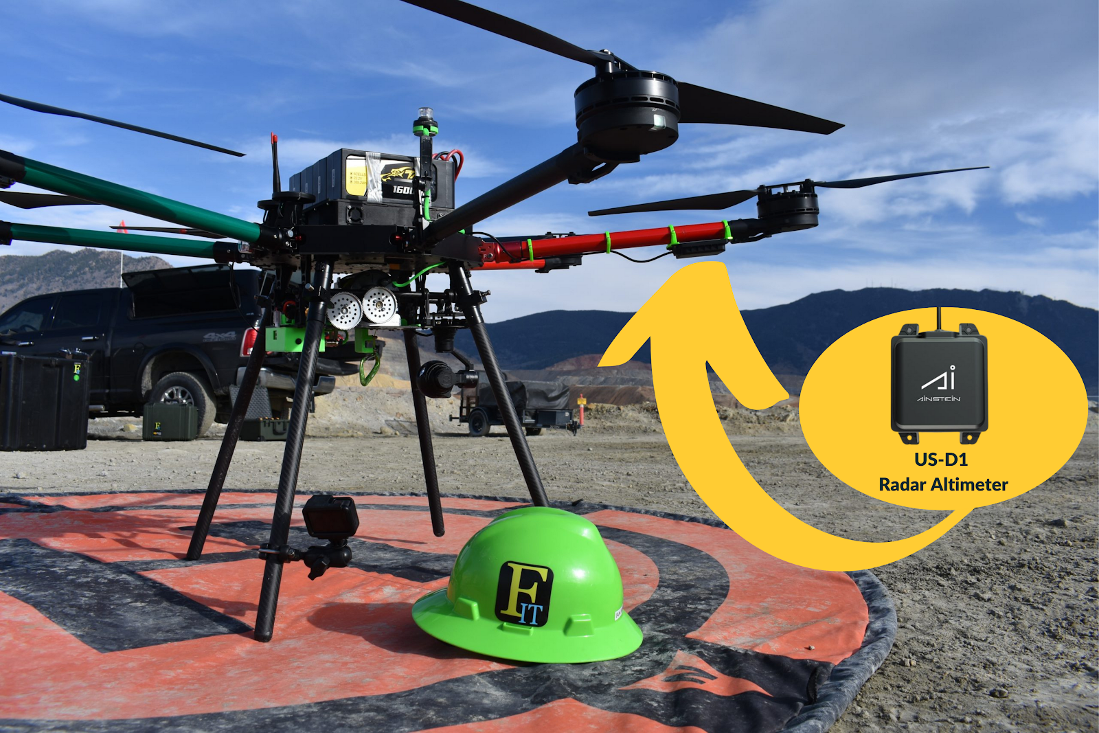
The Ainstein’s UAV Standard Radar Altimeter US-D1 is a mmWave Radar sensor that is mostly used for terrain tracking commonly required for precision agriculture. In a recent collaboration with their customer Fairweather IT (aka: FIT) from Montana, Ainstein enhanced FIT’s scientists and engineers’ drone based Water Sampling Platform (WaSP) with their sensor technology.
FIT’s drones are deployed in hazardous or inaccessible surface water bodies for routine sampling and monitoring. For any of their UAV projects that didn’t involve water, lidar worked great as a rangefinder. However, since most of FIT’s critical tasks occurred over bodies of water, lidar was not a usable solution. “Many people use a laser or lidar range finder which works great on land. Once we flew over water though, the numbers went all over the place. We looked at other lidar range finders -potentially using different wavelengths of light. We looked at different powers. We even looked at sonar but unfortunately sonar’s got a very short range.” Ainstein’s radar solution perfectly fitted their needs.
We are excited to share this success case study from our member company where the open drone ecosystem is creating value for the industry. By having interoperability parts like Pixhawk and Ainstein’s Radar Altimeter, enabling “plug-n-play” experiences for developers, allows the service providers to focus on their applications.
See the whole discussion here: https://ainstein.ai/drone-fit/ and the demo video from Ainstein below.